This video record of the talk “Reading Maps, Seeing the City: From Old Maps to Metropolitan Bangkok” invites viewers to explore how Bangkok has been captured on maps across different eras—from traditional maps, Ayutthaya–early Rattanakosin cartography, and colonial‑era mapping, to surveys produced by the Royal Thai Survey Department, as well as aerial photographs and contemporary GIS. The speakers encourage audiences to “read” the knowledge and viewpoints behind the “lines” on maps, revealing how power, expertise, and technology have shaped the making of Bangkok.

When Lines Tell the City’s Story: Reading Bangkok Through Maps
Research & Article
The second session of Museum in Focus, “Reading Maps, Seeing the City: From Old Maps to Metropolitan Bangkok,” reframes maps not just as navigation tools but as historical evidence that records how Bangkok has taken shape over time. From symbolic, cosmological maps to modern cartography and GIS, maps reveal how the city has been “seen, measured, and managed” in different eras. They show shifting worldviews, power relations, and technologies, allowing us to connect Bangkok’s past, present, and future through the layers of history still embedded in today’s urban landscape.Compiler : Chewasit Boonyakiet
Modern State-Building, Urban Governance, Urban Planning and Landscape, Western Influence in Siam, Western Technology, Maps and Geospatial Information, Reign of King Rama V
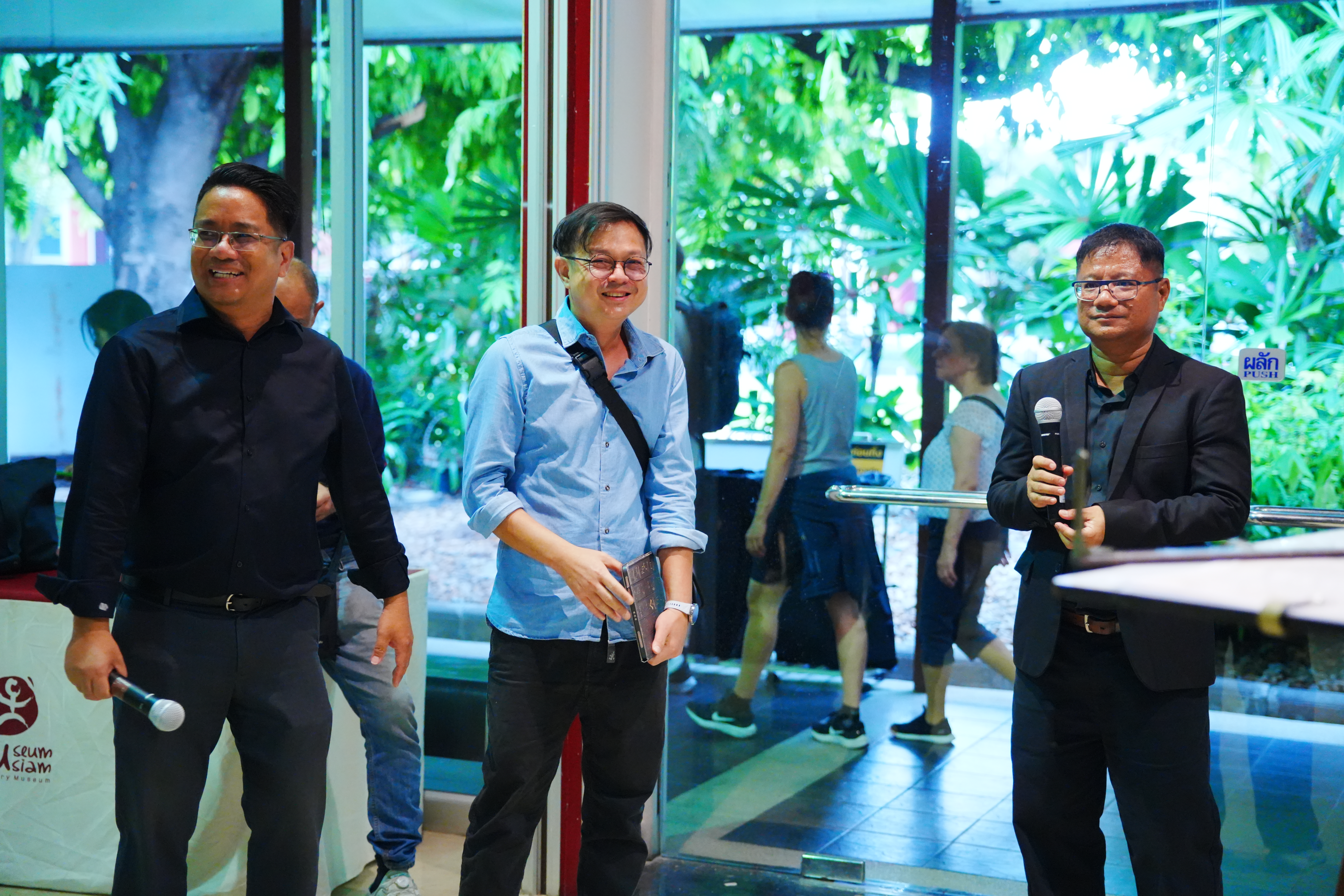
Maps are often seen as tools for finding places or planning routes, but in Museum in Focus on 27 December 2025, Museum Siam invited visitors to see them as historical evidence that records how Bangkok has taken shape over time. Through lines, symbols, and changing survey technologies, the talks asked how the city we live in today has been “seen, measured, and managed” in the eyes of people and the state in different periods.
The speakers guided participants to read maps as a kind of “language” that reflects ways of seeing, power, and knowledge—from traditional maps to modern cartography and digital geographic systems. Reading maps is therefore not only about looking back at the past, but also about understanding present‑day Bangkok through the traces that still lie in the city’s landscape. This series of articles draws out key ideas from the discussion and invites readers to slowly “read the city” and discover new meanings of Bangkok through what we call “maps”.
Maps as a Language of Power
Assoc. Prof. Peerasri Powathong from the Faculty of Architecture, Chulalongkorn University, opened the session with a simple but often overlooked question: “What is a map?” She explained that a map is not a neutral mirror of reality, but the result of choices—what to look at, what to filter out, and how to arrange information to say something specific. In this sense, a map works like a language with its own grammar, structure, and users.
From an academic perspective, a map turns three‑dimensional space into a two‑dimensional image by scaling it down, which always means leaving some things out. What is shown and what disappears both reveal the purpose behind the map—whether military, administrative, commercial, or exploratory. A map is therefore more than a locator; it is a tool of knowledge that decides “what matters” and “what should be seen” in the city.
Peerasri suggested that when we use maps as historical sources, we need to read “behind the lines” as well as on the ground. Every map reflects relationships between knowledge, technology, and power at the moment it was made. Understanding the city through maps is not only about asking what the city once looked like, but also about asking who had the right to define it, and through whose eyes the story of the city has been told.
From Worldviews to Scale
Assoc. Prof. Peerasri Powathong explained that to understand maps, we first need to see them as products of particular cultural worldviews. Maps in different civilizations are not made within the same frame of thinking; they reflect different ways of understanding the world. Western maps prioritize physical accuracy, measured scale, fixed directions using the compass, and coordinate systems and GIS technology that allow land to be managed, surveyed, and reproduced in a systematic way.
By contrast, many maps from the Eastern world, especially in Asia, do not aim to copy the landscape to scale. Instead, they highlight symbolic meaning, relationships between places, and centres of power or belief. Chinese maps, for example, place the imperial palace at the heart of the universe; Islamic maps emphasize sacred buildings; and Korean maps sometimes orient directions differently from today’s global standard. These maps may look “inaccurate” when judged by modern science, yet they are “correct” within the social and intellectual context of their own time.
In Thai society during the Ayutthaya period and early Rattanakosin, maps worked more like diagrams of power relations. Cities, temples, palaces, and waterways were arranged according to social and ritual importance. To read these maps, we need to shift our focus away from searching for geometric precision and instead ask how people in the past perceived and imagined their own city.
Maps and the Making of a Modern Capital
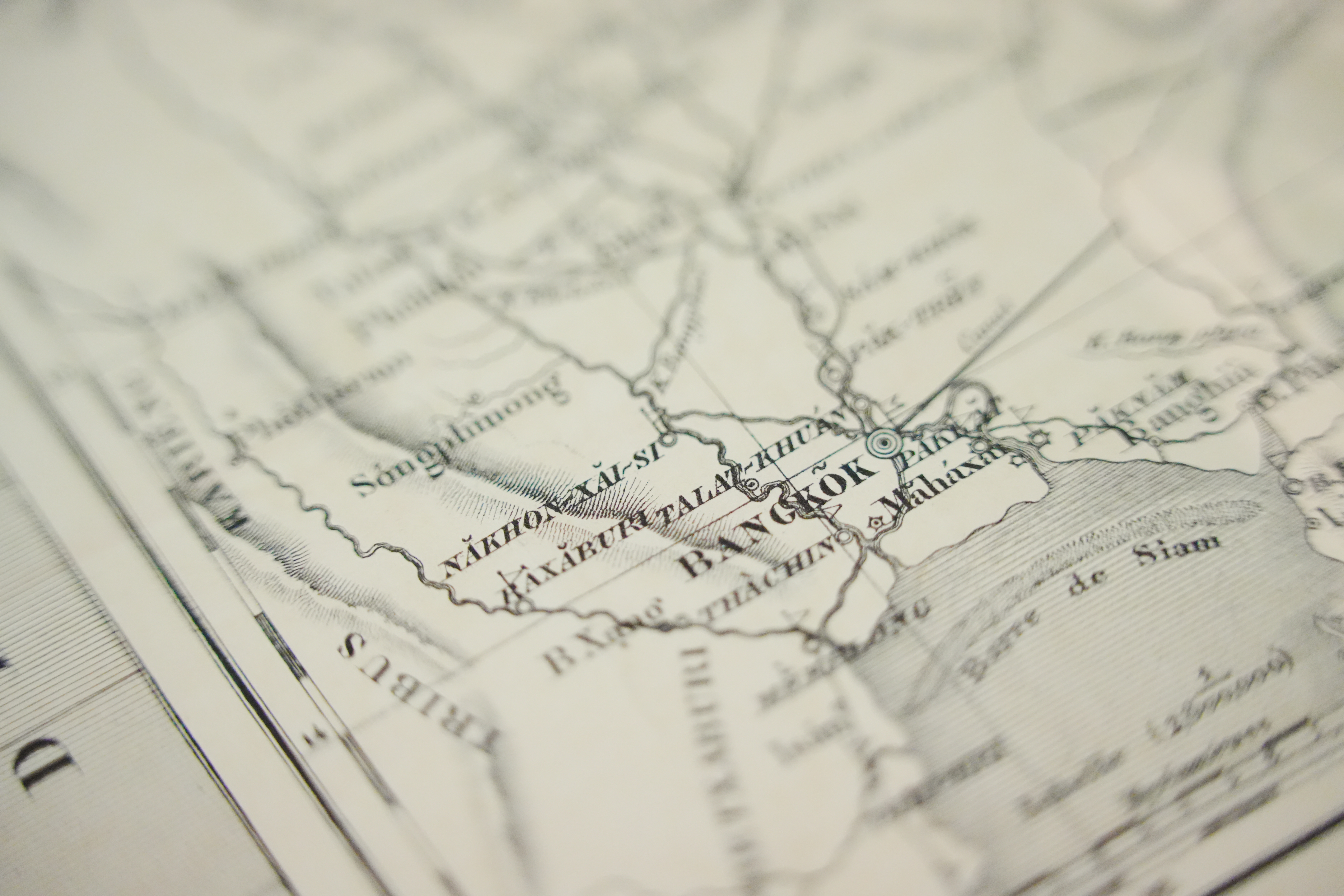
From the late eighteenth to the early twentieth century, Bangkok gradually began to appear on maps as the capital of a state adapting to the modern world. During this period, Peerasri notes, maps of Bangkok reveal a major shift: from understanding the city through lived experience and social relations, to seeing it as a space that could be measured, controlled, and systematically managed.
Maps produced by Western surveyors and diplomatic missions, such as those by John Crawfurd, are key evidence of this process. The city was recorded from an elevated, geometric viewpoint, with clear lines for rivers, canals, city walls, and important sites. Even with their limits in accuracy, these maps expressed a new way of thinking about Bangkok. They helped Western observers read the city in a familiar visual language, while at the same time reshaping how the Siamese state itself perceived its capital.
In Siam, modern maps were not just imported Western products; they became strategic tools of the state for asserting sovereignty, conducting diplomacy, and managing internal affairs. Bangkok’s maps slowly shifted from traditional representations to formal administrative documents used for urban planning, taxation, land allocation, and infrastructure. The capital was transformed into data on a map—ready to be organised and governed according to the logic of the modern state.
The Royal Thai Survey Department and the Technology of Mapping the City
Col. Sompoch Pandawangkur, Director of the Map Information Center at the Royal Thai Survey Department, explained that mapmaking in Siam changed significantly during the reign of King Chulalongkorn (Rama V), when the state needed tools to “see” its territory in a systematic way. Maps were no longer just illustrations or reference documents; they became key technologies for recording the city, defining boundaries, and allowing different parts of Bangkok to be “seen” and governed from the centre.
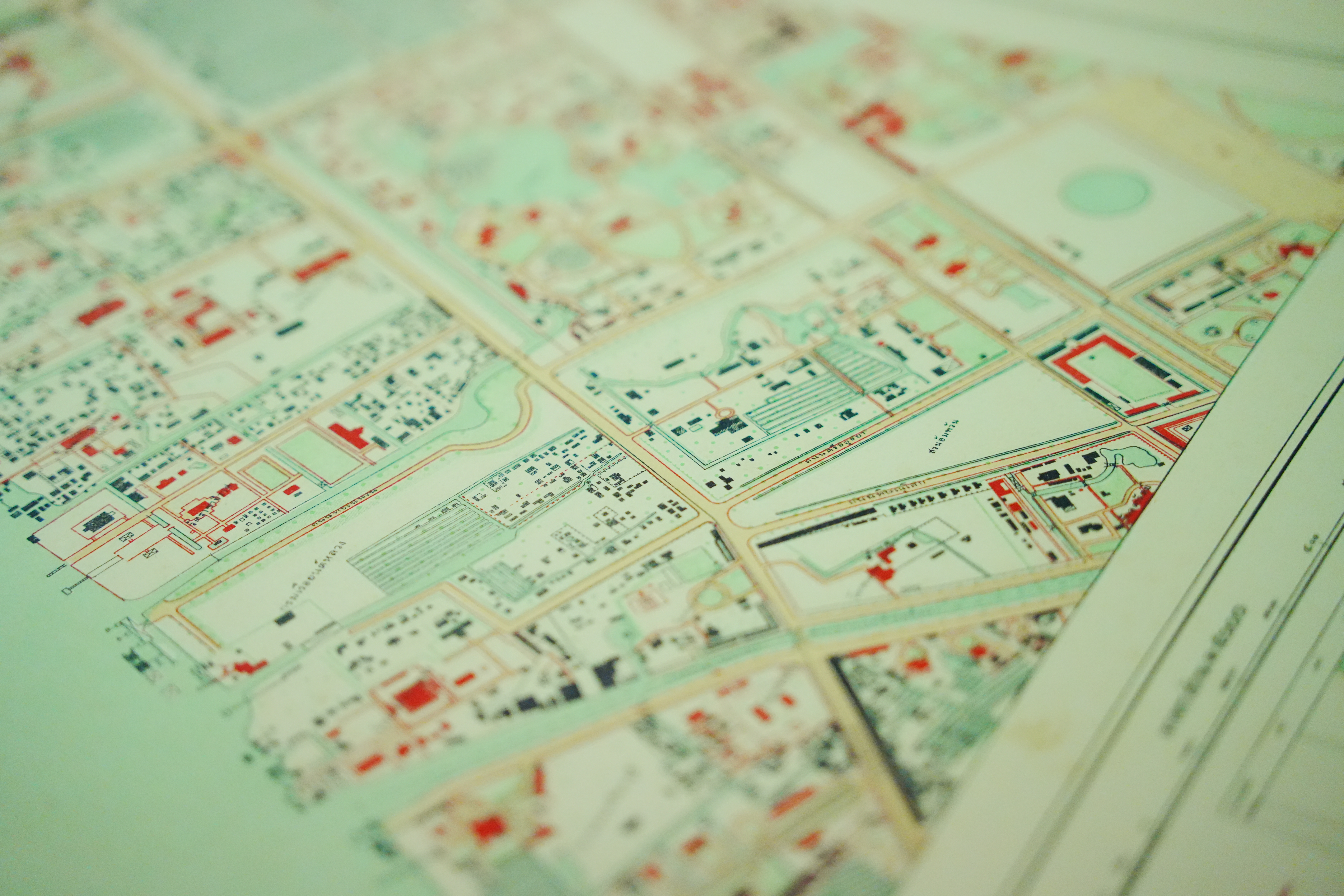
Western surveying techniques—such as field surveys, the use of precise scales, and coordinate systems—made maps of Bangkok more accurate than ever before. Sompoch highlighted the 1887 map of Bangkok by James McCarthy, which clearly shows rivers, canals, roads, city walls, and other important areas. This map was not simply the work of a foreign expert; it was produced in collaboration with Thai staff and uses Thai place‑names throughout, so it could be directly applied in running the city.
As maps became more precise, their role expanded from military use to broader urban management. They were used to plan the city, issue land titles, resolve land disputes, and even respond to emergencies such as major fires in the Sampheng district. In this way, maps functioned as “records of the city” at specific moments in time, allowing the state to see and respond to Bangkok’s changes in concrete, visible form.
The Evolution of Mapping Technologies
Col. Sompoch pointed out that Siam’s mapping technologies developed gradually through learning, experimentation, and adaptation to the needs of the city and the state. In the early stages, mapping relied mainly on field surveys: surveyors had to go on site, use measuring instruments, draw lines, and record information on portable drawing tables. Maps from this period were closely tied to the surveyors’ direct experience and reflected practical limits such as time, available tools, and local conditions.
As the city expanded and the state’s responsibilities became more complex, recording space through ground surveys alone was no longer enough. Aerial photography began to play a key role. Images taken from above made it possible to see the city plan as a whole and to grasp the relationships between rivers, canals, roads, and neighbourhoods at a glance. Col. Sompoch explained that aerial photos did not replace traditional mapping; they worked together with ground surveys to increase accuracy and reduce errors in documenting the city.
Today, mapping technologies have moved into the realm of Geographic Information Systems (GIS), which turn maps from paper sheets into spatial databases. The city is no longer captured as a single, static image, but as layered information that can connect land, land use, infrastructure, and population data in one system. This allows the state to monitor, analyse, and plan urban change on an ongoing basis.
Yet, Col. Sompoch emphasized that no matter how advanced the technology becomes, the core idea remains the same: maps are tools that make a place “visible” through the knowledge framework of each era. From field drawing boards, to aerial photographs, to digital databases, mapping technologies are not only technical achievements, but also a history of how societies learn about, make sense of, and systematically manage their cities.
Reading the Past in Maps to Understand the Present
This Museum in Focus session showed that reading maps is not just a way of looking back at the past, but a way of making sense of Bangkok today. Maps act as evidence that records how the city has changed over time—from defining territory, cutting new roads, and demolishing city walls, to reorganising land plots—all of which have shaped the urban life we now take for granted.
Placing maps from different periods side by side reveals that many features of Bangkok did not appear by accident. Street names, canal lines, small alleys, and open spaces all have historical reasons behind them. Assoc. Prof. Peerasri Powathong stressed that today’s city is the outcome of past decisions, preserved in maps; understanding this past helps us see Bangkok in greater depth and question ongoing changes with a more critical eye.
At the same time, Col. Sompoch Pandawangkur noted that modern mapping technologies—especially GIS—allow maps to connect past, present, and future. The city is no longer just a static picture, but data that can be analysed and used to plan development over time, provided that users know how to read and interpret this information within the city’s historical context.
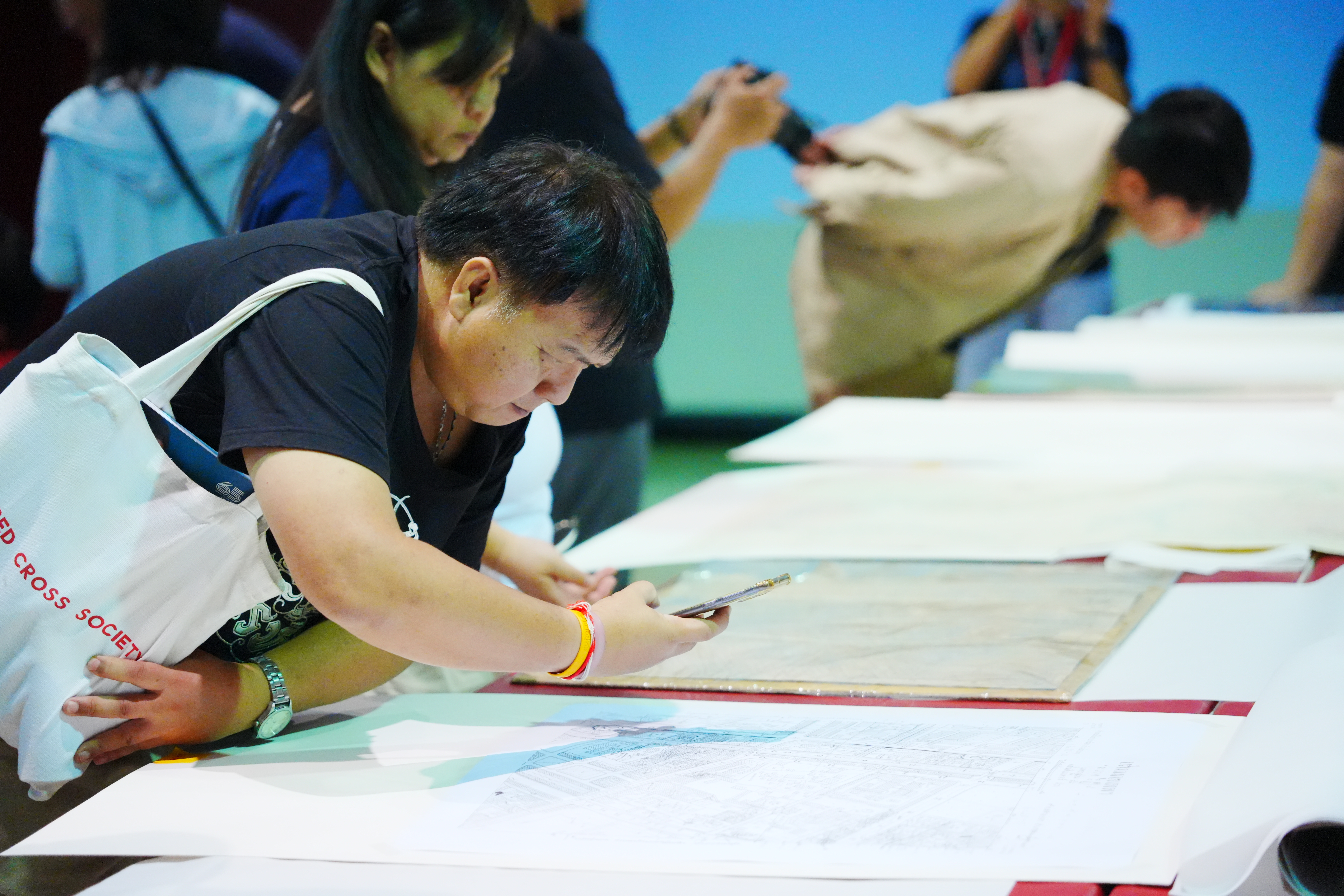
A key takeaway from the discussion is that map‑reading should not be reserved for experts alone. Maps can be everyday learning tools that help the public see Bangkok as a layered city, full of traces and stories embedded in every corner. To read maps is to practise reading the city itself, to question the landscape around us, and to open up ways of understanding the past that can meaningfully inform how we imagine Bangkok’s future
-
Reading Bangkok Through Maps Panel
Zooming In on Old Siam
Capturing details in maps
Layers of the city
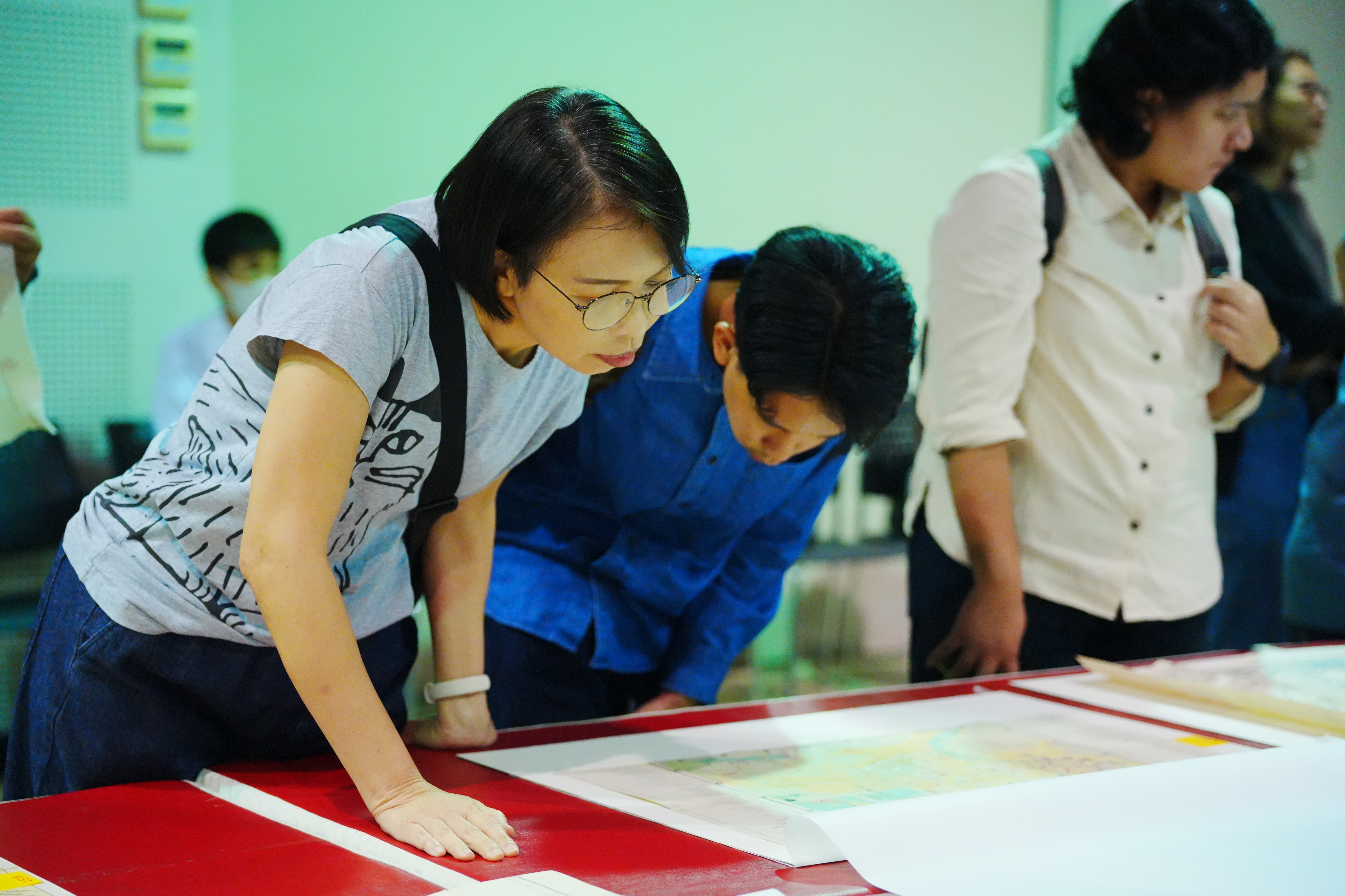
Reading Maps Together
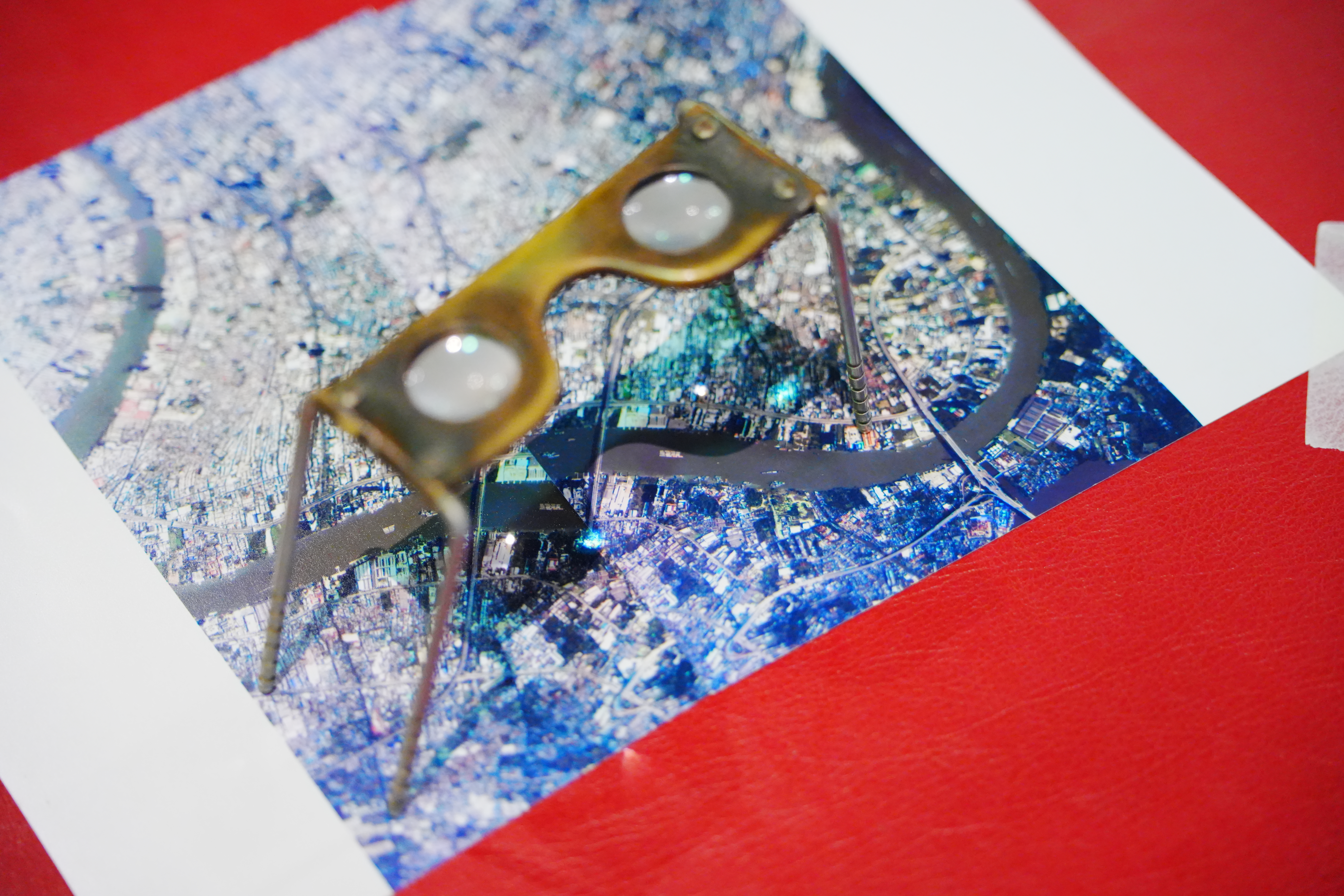
Seeing Bangkok in Stereo
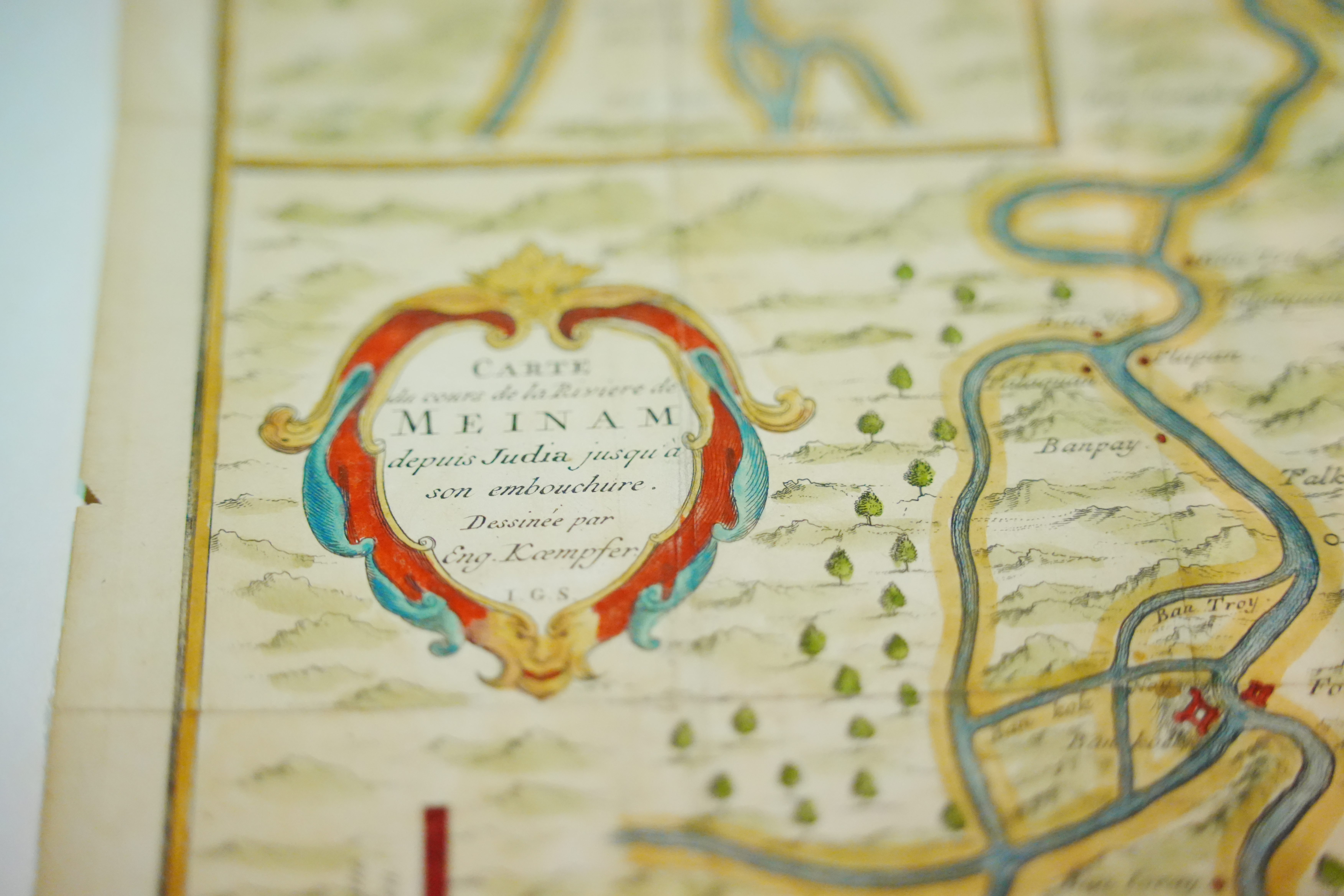
Kaempfer’s Meinam Map
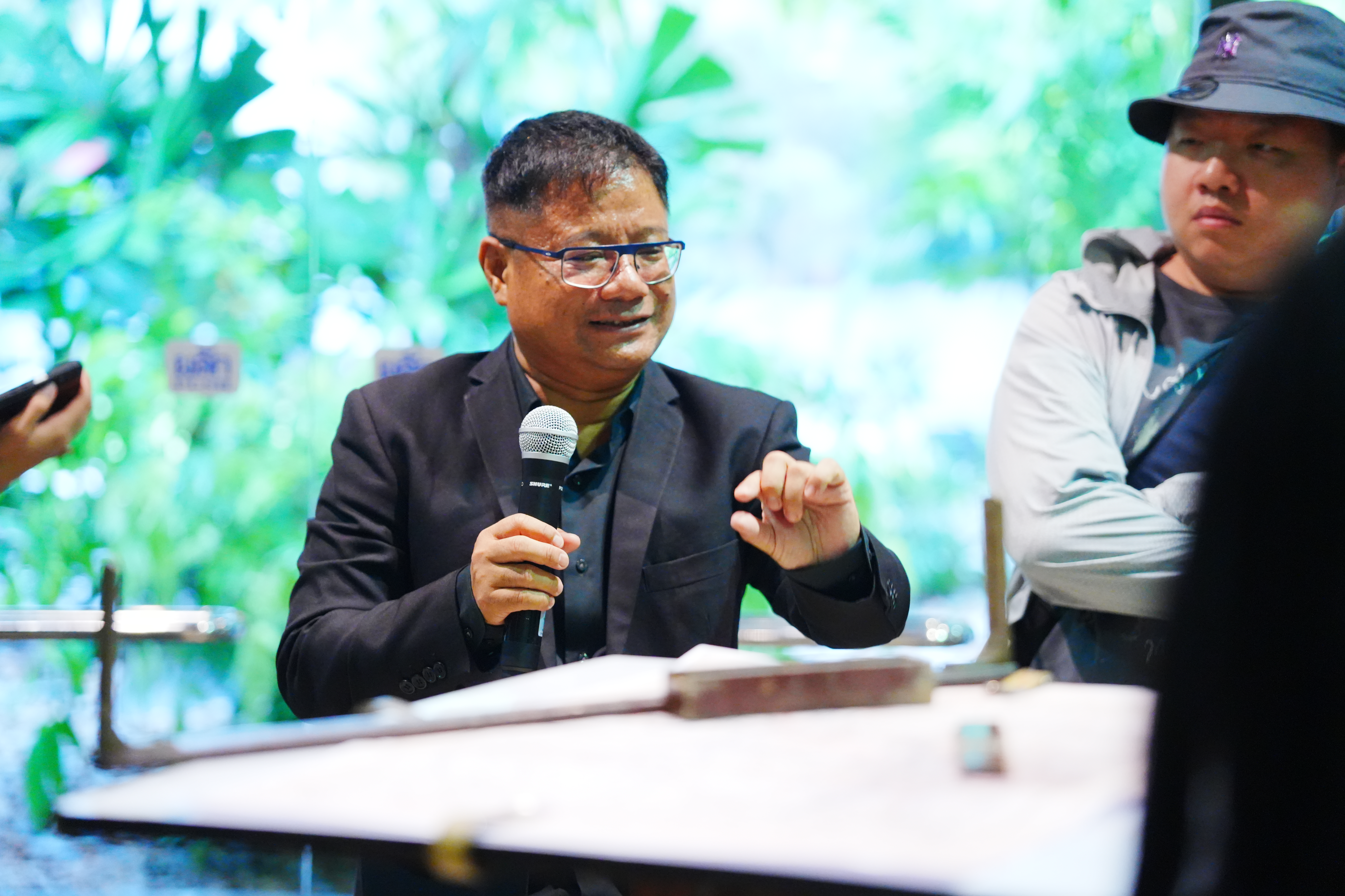
Explaining Survey Mapping
- National Discovery Museum Institute
4 Sanam Chai Rd., Phra Nakhon, Bangkok 1200 THAILAND
- Opening hours: at 10.00 a.m.- 6.00 p.m. Tuesday-Sunday (closed on Mondays)
- Tel. : 02 225 2777
- Fax. : 02 225 2775


